

Section: Overall Objectives
Context
Coastal zones are the theatre for numerous interfaces. The main elements that come to mind are the sea/earth interface, saline/brackish/fresh water interfaces and sediment/biological world interfaces. These elements cause most of the phenomena met within coastal zones to be in fragile equilibrium or more often, in constant evolution. This is due to the evolving external pressures, such as anthropic activity or physical forces (tectonic features, tide, precipitations, storms, sea level rise, sediment transport, etc.). In order to illustrate the considerable importance of such a research project, let us underline the following figures:
-
60 % of the world population lives in a 100km wide coastal strip (80% within 30km in Brittany),
-
current sea level rise has occurred at a mean rate of 1.8 mm per year for the past century, and more recently at rates estimated near to mm per year (1993-2003). It is likely to rise in the future: IPCC recently anticipated a 1.5m sea level rise within the next century,
It results that coastal management requires the development of theoretical and applied models to facilitate the decision process. For example, a city that wants to develop a harbour needs to anticipate the time-evolution of urban floods. The construction of defense barriers to protect buildings and houses from natural hazards relies on the knowledge of potential submersion events, in a period where the impact of global climatic and anthropic changes on the coastal zone is expected to generate increased coastal risks (IPCC 2007 and 2013). One also needs to analyze "what if" scenarios for proposed changes in land use or land cover in coastal regions (such as French Mont Saint-Michel).
As a matter of fact, the software packages available for engineering applications are usually not satisfactory. More specifically, some modeling hypotheses (such as the hydrostatic approximation) should be weakened, and more appropriate numerical schemes should be implemented. What is proposed with LEMON is to increase the quality of coastal engineering numerical tools, thanks to better designed mathematical and numerical models.
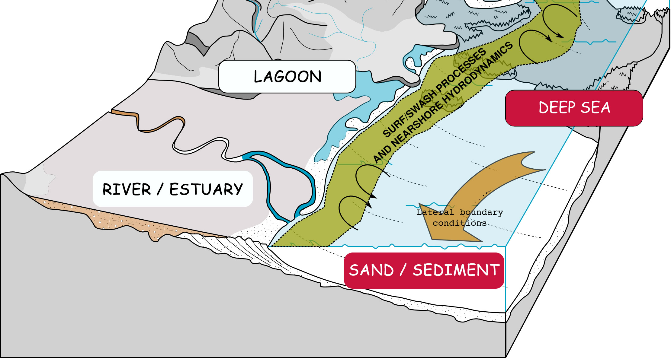
The mathematical modeling of the phenomena occurring within coastal zones and their interactions is currently a major scientific issue. If we want to model coastal zones, we have to consider the fact that they cover a very wide range of situations and that they are the result of several complex interacting phenomena (see Figure 1 ). More specifically, many time scales and space scales are involved and many physical and biological phenomena are in action. Moreover, within each zone, specific interactions between those phenomena make it an almost unique situation. Hence, we are far from having a database aggregating every possible situation. Modeling complex phenomena with the objective of building and improving management/decision tools requires the interaction of several models, each of them being dedicated to the simulation of a specific process. Such (mathematical and numerical) models usually exist but scarcely interact: therefore there is a need to understand how these bricks can be modified (forcing terms, boundary conditions) in order to be assembled. It will require a dialog with specialists of the application domain (geophysics, mechanical engineering, biology, hydrology, etc.) to help to develop new mathematical and numerical models for coastal engineering.
Developing more accurate and/or less CPU demanding models and coupling them together, LEMON will have a strong impact in the applications targeted and in coastal management.