Section: New Results
Multisensory Maps and 3D Printed Interactive Maps for Visually Impaired People
Participant: Anke Brock
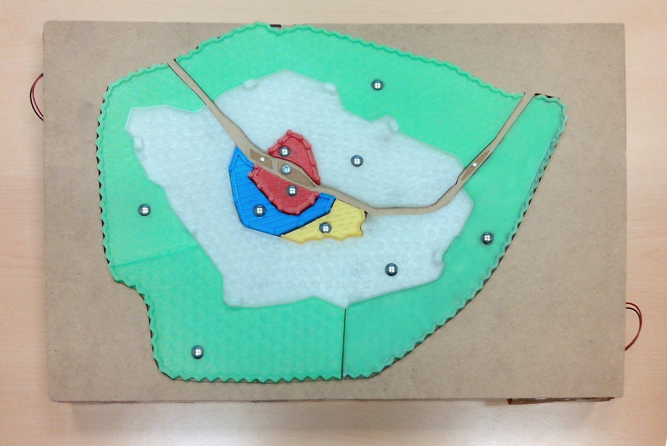
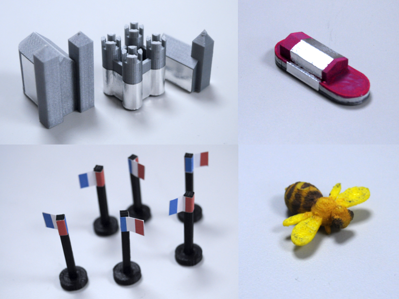
Visually impaired people face important challenges related to orientation and mobility. Accessible geographic maps are helpful for acquiring knowledge of an urban environment. Historically, raised-line paper maps with braille text have been used, but these maps possess significant limitations. For instance, only a small percentage of the visually impaired population reads braille. Recent technological advances have enabled the design of accessible interactive maps with the aim to overcome these limitations. We designed Mappie, an accessible interactive map prototype based on the use of a multi-touch screen with a raised-line map overlay and speech output (Figure 8). Then, we deployed Mappie in a class of seven children and one caretaker during three months. Our formative study showed promising results and allowed insights in the design of accessible interactive maps, such as using olfactory and gustatory modalities to foster reflective learning, and using tangible objects to support storytelling. Following this first study, we designed MapSense as an extension of Mappie. MapSense uses the same hardware and interaction techniques as Mappie, but additionally provides fourteen ”Do-It-Yourself” conductive tangibles. Some tangibles could be filled with scented material, such as olive oil, smashed raisins or honey, thus creating a real multi-sensory experience. The map was explored during two classes of three hours separated by a week, taught conjointly by a locomotion trainer and a specialized teacher. We observed that the map and tangible objects triggered strong positive emotions and stimulated spatial learning as well as creativity of the visually impaired students. This work has been conducted as part of the PhD thesis of Emeline Brulé under the supervision of Gilles Bailly and Annie Gentes, and in collaboration with the IRIT research lab in Toulouse. It has been published at CHI'16 [20].
As part of the postdoc of Stephanie Giraud at IRIT Toulouse under the supervision of Christophe Jouffrais, we have investigated how to print entire interactive maps in 3D, allowing users to construct a city like using a puzzle. We have conducted a user study comparing an interactive map that has been entirely 3D printed to a raised-line map with braille text (Figure 8 left). Our results suggest that the interactive map is significantly more effective for providing spatial knowledge than a tactile paper map with braille.