

Section: Partnerships and Cooperations
National Initiatives
ANR BLANC: ALTA
Participants : Nicolas Holzschuch [contact] , Cyril Soler.
We are funded by the ANR research program "Blanc" for a joint research project with two other Inria research teams, REVES in Sophia-Antipolis and Manao in Bordeaux. The goal of this project is studying light transport operators for global illumination, both in terms of frequency analysis and dimensional analysis. The grant started in October 2011, for 54 months.
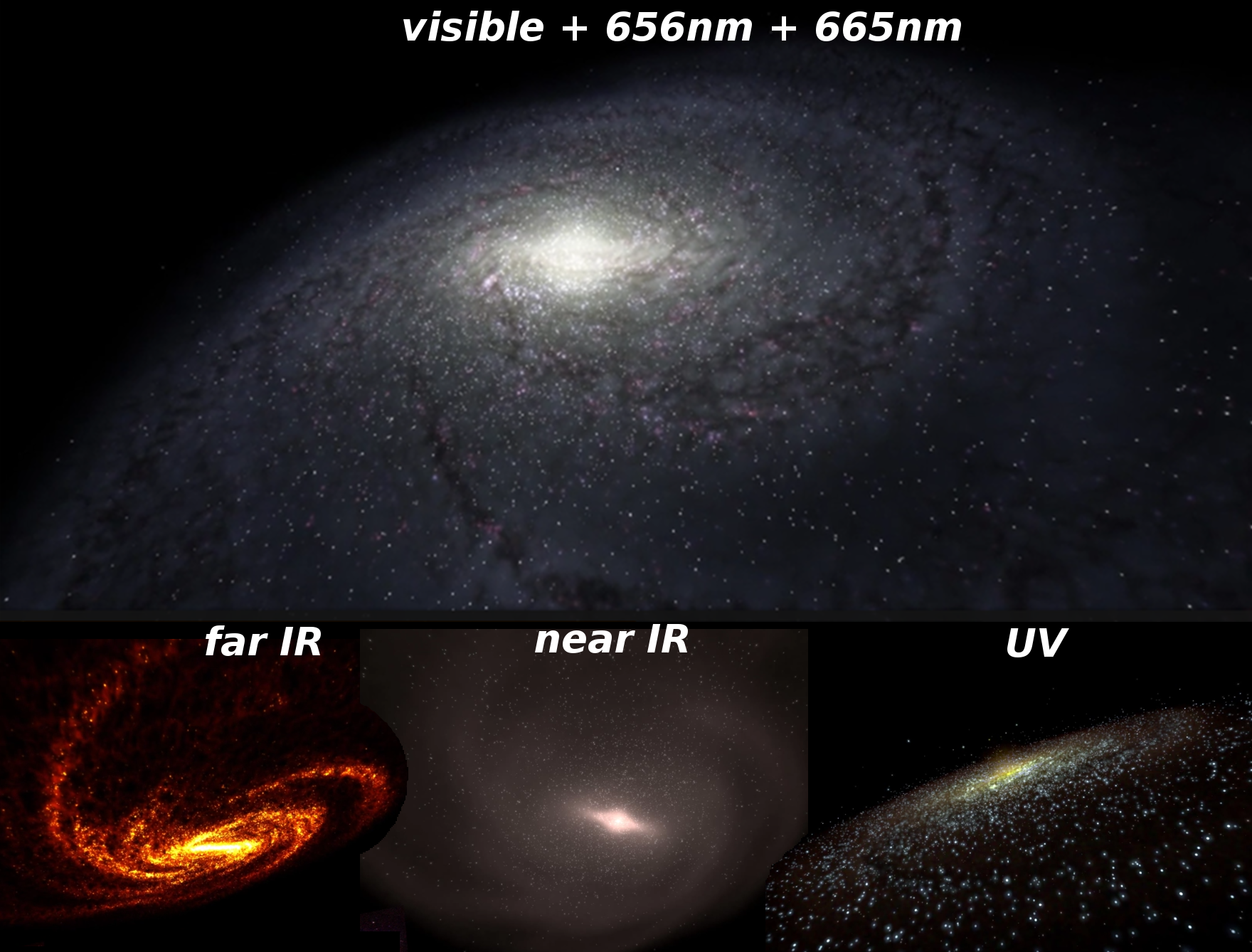
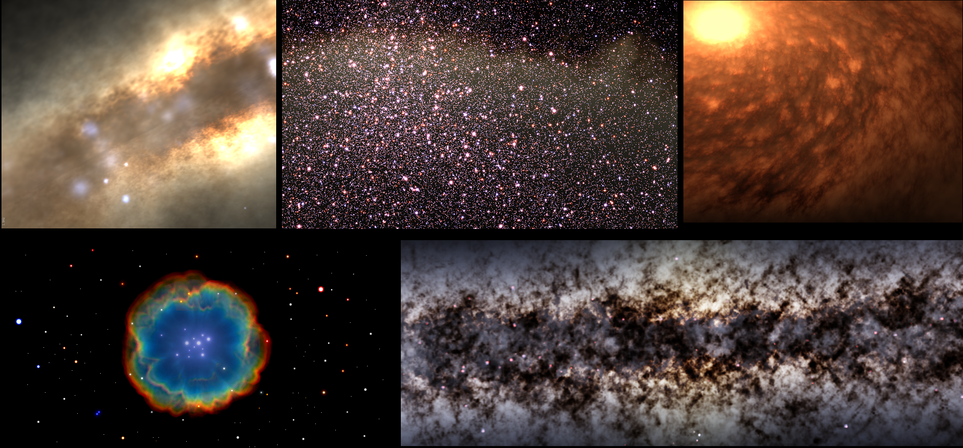
ANR CONTINT: Galaxy/veRTIGE
Participants : Jean-Dominique Gascuel, Nicolas Holzschuch, Fabrice Neyret [contact] .
RTIGE stands for Real-Time and Interactive Galaxy for Edutainment. This is an ANR CONTINT (Contents and Interactions) research program, for a joint research project with the EVASION Inria project-team, the GEPI and LERMA research teams at Paris Observatory, and the RSA Cosmos company. The goal of this project is to simulate the quality multi-spectral real-time exploration of the Galaxy with Hubble-like images, based on simulation data, statistical data coming from observation, star catalogs, and procedural amplification for stars and dust clouds distributions. RSA-Cosmos aims at integrating the results in digital planetariums (See Figures 16 and 17). The grant started in December 2010, for 60 months.
|
ANR CONTINT: MAPSTYLE
Participants : Joëlle Thollot [contact] , Hugo Loi.
The MAPSTYLE project aims at exploring the possibilities offered by cartography and expressive rendering to propose original and new cartographic representations. Through this project, we target two types of needs. On the one hand, mapping agencies produce series paper maps with some renderings that are still derived from drawings made by hand 50 years ago: for example, rocky areas in the series TOP25 (to 1/25000) of the French Institut Géographique National (IGN). The rendering of these rocky areas must be automated and its effectiveness retained to meet the requirements of hikers safety. On the other hand, Internet mapping tools allow any user to become a cartographer. However, they provide default styles that cannot be changed (GeoPortal, Google Maps) or they are editable but without any assistance or expertise (CloudMade). In such cases, as in the case of mobile applications, we identify the need to offer users means to design map styles more personalised and more attractive to meet their expectations (decision-making, recreation, etc.) and their tastes. The grant started on October 2012, for 48 months.
ANR: Materials
Participants : Nicolas Holzschuch [contact] , Romain Vergne.
Participants: Nicolas Holzschuch [contact], Romain Vergne. We are funded by the ANR for a joint research project on acquisition and restitution of micro-facet based materials. This project is in cooperation with Océ Print Logic technologies, the Museum of Ethnography at the University of Bordeaux and the Manao team at Inria Bordeaux. The grant started in October 2015, for 48 months.